About Coastal Engineering Division
The Coastal Engineering Division was formed in the year 1978, which is headed by Chief Research Officer, to this division
three sub divisions which were headed by Research Officers has been attached to this division.
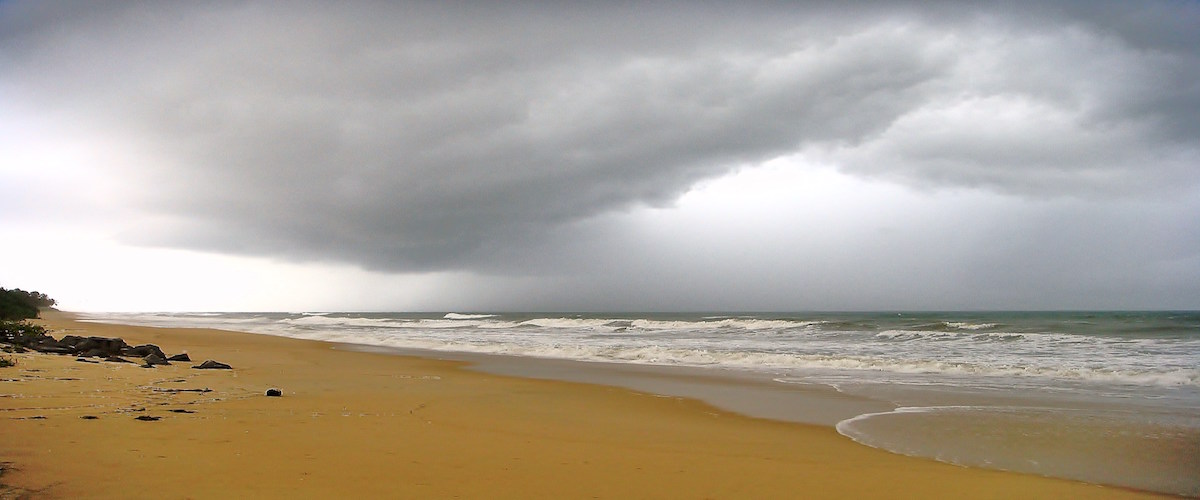
Karnataka has a west coast line of about 300Km which stretches from Karwar to Mangalore, broken up with a number of estuaries
formed due to draining of large number of rivers joining the Arabian Sea. These rivers carry heavy floods during the monsoon.
A number of minor ports mostly for fishing activities have been developed along the coast, at the river mouths. The beaches
being narrow in most parts are not very effective in protecting the adjoining fertile garden lands and properties.
![]()
Roles and Objectives of Division.
- Identification of the problematic Areas, pertaining to the erosion at open beaches, River Mouths etc.,
- Coastal Engineering Division office acts as a link between the director’s office and sub- divisions in terms of collection,
assessing and compilation of the coastline data and providing solutions to the erosion prone regions
- Collection of the Erosion Site Details, and intensity of the erosion.
- To carry out works entrusted by technical experts committee on flood control and ASE works constituted by Government
of Karnataka as a member of the committee.
- Conducting the monthly review meeting of subdivisions for the progress achieved.
- Periodical visiting of the on-going and completed permanent sea wall sties for the evaluation of the performance of the
sea walls for Tidal Actions.
- Identified the chainages of the coast line villages, by procuring the maps from district NRDMS
- Calling of Tenders pertaining to the Beach Profile surveys and Offset Surveys.
Strengths
- Coastal Engineering Division has capable of carrying out the research activities and data collection pertaining to the
coastal region of Karnataka.
- Can take up the Pre and Post Dredging survey operations at the ports including calculation the dredging volume preparation
of 3D- Bathymetric maps.
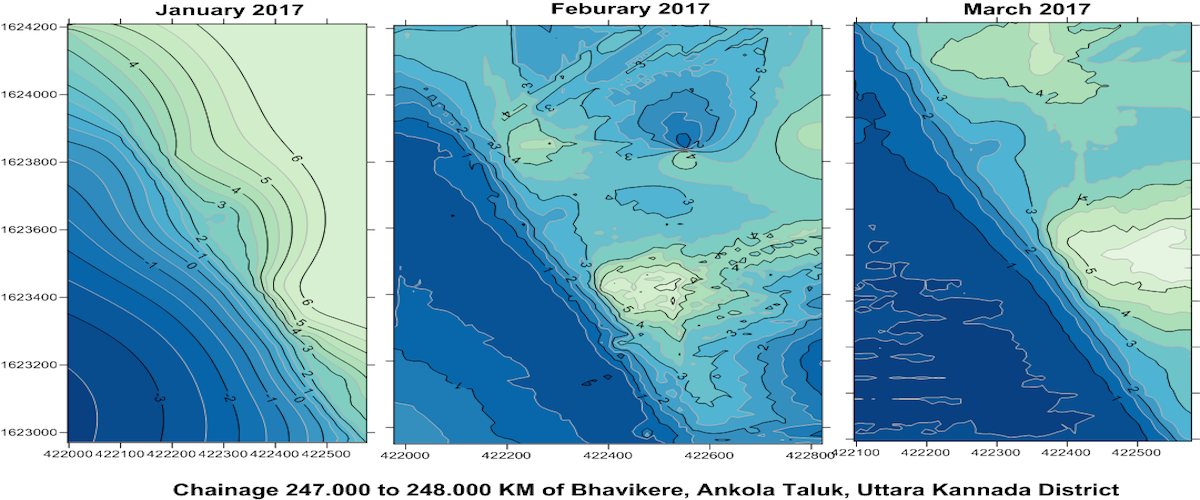
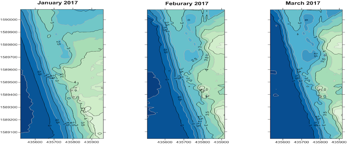
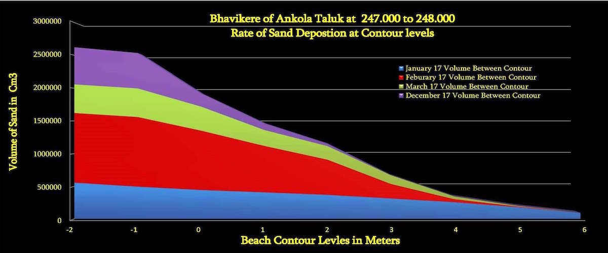
- Beach Profile Survey data comparison for the assessing the beach contour movement, sand volume estimates and average
beach profile line establishment.
Contact Details
H B Krishna Roa (I/c)
Chief Research Officer
Coastal Engineering Division
Karnataka Enginring Research Station
Krishnarajasagara, Mandya
Karnataka – 571607
Phone (O) : 08236-297270
Cell : +91 7795055551