Hydrographic surveys and reservoir management are two essential aspects of sustainable water resource planning. The Karnataka Engineering Research Station (KERS) has developed advanced techniques to carry out these tasks with high precision. The main goal is to collect accurate data, manage reservoirs effectively, and ensure the long-term availability of water. Proper management of reservoirs requires real-time monitoring, periodic assessment, and use of modern equipment. KERS plays a crucial role in achieving all these objectives for the state of Karnataka.
Table of Contents
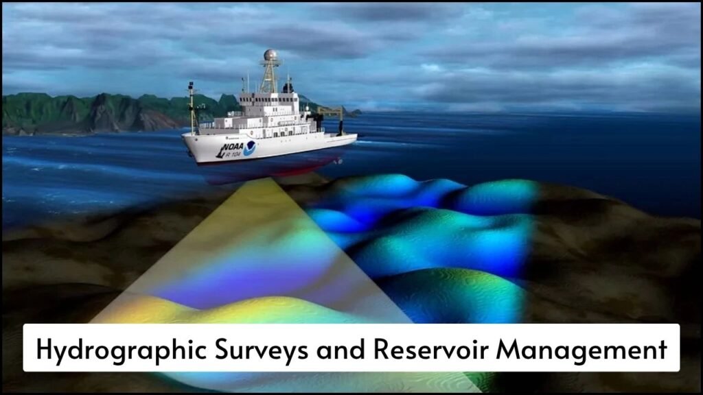
Hydrographic Surveys by KERS
Hydrographic surveys are conducted to measure and map the features of water bodies, including rivers, lakes, and reservoirs.
- Bathymetric Mapping
Bathymetric data helps in understanding the depth and underwater features of reservoirs.- Echo sounders and GPS are used for accurate measurements.
- Data helps in creating digital elevation models.
- Reservoir sedimentation patterns are studied with this data.
- Shoreline Surveys
These surveys record the boundaries of reservoirs and monitor changes in storage capacity.- Drones and satellite images are used for shoreline identification.
- Changes in the water spread area are detected seasonally.
- Encroachments and illegal activities are also monitored.
- Cross-Section Surveys
Cross-section profiles help assess siltation and storage changes in rivers and reservoirs.- Data collected at regular intervals helps track sediment buildup.
- Flow capacity and safety levels of reservoirs are calculated.
- Volume Computation
KERS uses advanced software to compute the storage capacity of reservoirs.- Data from surveys is fed into GIS-based tools.
- Accurate water availability is estimated.
- Helps in water distribution planning.
Hydrographic Survey Techniques Used by KERS
| Survey Type | Tools Used | Purpose |
|---|---|---|
| Bathymetric Survey | Echo Sounders, GPS, Total Stations | Measure underwater depth and reservoir floor |
| Shoreline Survey | Drones, Satellite Imagery | Identify water spread and monitor boundaries |
| Cross-Section Survey | Survey Rods, GPS Devices | Study siltation and flow pattern |
| Volume Estimation | GIS Software, Hydrological Data | Calculate water storage and predict availability |
Advanced Techniques in Hydrographic Surveys
Modern technology has made it easier for KERS to collect high-quality data within a short time.
- Real-Time Kinematic (RTK) GPS: High precision GPS is used for locating exact positions during surveys.
- Single Beam Echo Sounder: Provides accurate depth readings of a single point at a time.
- Differential GPS (DGPS): Helps in correcting GPS data errors during field operations.
- Total Station Surveying: Used in areas where satellite signals are weak.
- Unmanned Aerial Vehicles (UAVs): Drones provide aerial views and help in mapping inaccessible areas.
Reservoir Management by KERS
Reservoir management ensures water is stored and distributed efficiently and sustainably.
- Siltation Studies
Silt accumulation reduces reservoir capacity.- KERS conducts siltation surveys regularly.
- Data helps in planning desilting operations.
- Reduces flood risk and improves water availability.
- Spillway Discharge Analysis
Accurate assessment of spillway capacity is necessary for dam safety.- Hydraulic models are used to simulate discharge flow.
- Prevents overflow and ensures structural safety.
- Water Level Monitoring
Continuous monitoring of water levels helps in decision-making during droughts and floods.- Remote sensors are installed at various points.
- Real-time data is transmitted to control rooms.
- Helps in releasing water for irrigation and drinking purposes.
- Sedimentation Modelling
Predictive tools are used to estimate future sediment loads.- Helps in planning the lifespan of reservoirs.
- Supports catchment treatment programs.
Reservoir Management Functions by KERS
| Management Activity | Purpose | Tools/Methods Used |
|---|---|---|
| Siltation Analysis | Monitor and manage sediment deposits | Survey Data, GIS Modelling |
| Spillway Flow Simulation | Ensure safety during heavy rains | Hydraulic Models, Field Instruments |
| Water Level Monitoring | Track reservoir levels in real-time | Sensors, Remote Data Systems |
| Sediment Forecasting | Plan for long-term capacity management | Sedimentation Models, Hydrological Data |
| Evaporation Estimation | Measure loss of water from open surfaces | Pan Evaporation Method, Weather Stations |
Integration of Data and Decision Making
KERS integrates survey and monitoring data for better planning and operation of reservoirs.
- Decision Support Systems (DSS)
These systems provide simulations and suggest actions based on real-time data.- Rainfall predictions and reservoir levels are connected.
- Automated alerts are generated in critical conditions.
- Farmers and local authorities are informed about water release.
- GIS Integration
Geographic Information System maps help in visualizing survey data.- Encroachments are identified easily.
- Changes in catchment land use can be tracked.
- Cloud-Based Storage
Survey and monitoring data is stored on cloud platforms.- Enables data sharing across departments.
- Improves collaboration and planning.
Benefits of KERS’ Advanced Techniques
The advanced methods adopted by KERS have brought several benefits to Karnataka’s water management system.
- Accurate Capacity Estimates: Helps in the proper allocation of water for agriculture, drinking, and industry.
- Reduced Risk of Floods: Early detection of high inflow helps prevent overflow disasters.
- Better Drought Planning: Reservoir levels are managed smartly even in dry seasons.
- Improved Dam Safety: Continuous monitoring reduces the chances of dam failure.
- Enhanced Water Governance: Real-time data supports policy decisions and resource sharing.
Key Advantages of KERS’ Techniques
| Aspect | Benefit Achieved |
|---|---|
| Real-Time Monitoring | Faster response to emergencies |
| Accurate Survey Tools | Improved reliability of data |
| Predictive Modelling | Long-term planning for water resource management |
| GIS and UAV Integration | Better visual interpretation and analysis |
| Multi-Stakeholder Access | Transparent and efficient water governance |
In Summary
KERS has modernized hydrographic surveys and reservoir management through the use of advanced technologies and scientific tools. These methods ensure better decision-making, higher reservoir efficiency, and reduced environmental impact. Real-time data, predictive models, and integrated planning systems have made Karnataka a leader in water resource management. Future developments will continue to rely on these robust techniques for sustainable growth and water security.